Search Parcels, Values, Taxes & Maps
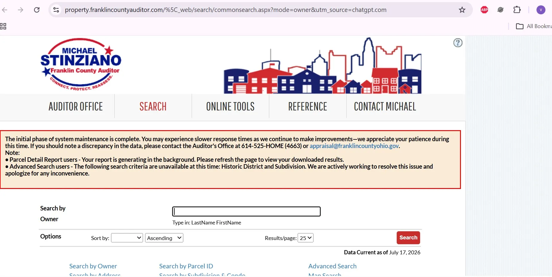
Find a Franklin County property by owner name, street address or parcel ID, then use the result to check ownership, building facts, sales, taxes, tentative value and map information.
The steps below explain exactly what to enter, what each record field means, how to fix a failed search and which county office handles the next action.
Choose what you need to do
Use the parcel search first when you do not yet have the parcel ID. After that, move to the office that controls the specific record.
How to search Franklin County property records
The official system supports Owner Name, Address, Parcel ID, Subdivision & Condo, Advanced Search and Map Search. Most users should begin with one of the first three methods.
- Enter the last name first.
- Add the first name only when the result list is too broad.
- Remove apostrophes, quotation marks, middle initials and suffixes if no result appears.
- Try a trust, LLC or former-owner name when applicable.
- Verify the property address and parcel ID.
- Enter the house number.
- Select the direction only when relevant.
- Enter the main street name.
- Do not include Road, Avenue, Boulevard, Street or Place initially.
- Add unit information only when several records remain.
- Copy the number from a tax bill, deed or earlier parcel record.
- Remove dashes and spaces.
- Enter the full number for one property.
- Use a wildcard only for grouped research.
- Confirm the address before continuing.
Beginner-safe search workflow
Property missing? Use this troubleshooting order
Prepare before calling the Auditor
What to do after you find the parcel
Understand the fields before using the record
Field |
What it means |
What to check next |
|---|---|---|
Parcel ID |
The county identifier assigned to the real-estate parcel. |
Use it for taxes, maps, documents, alerts, forms and county calls. |
Owner |
The ownership name currently displayed in the Auditor database. |
Use the recorded deed when legal proof of ownership is required. |
Property address |
The physical or situs location of the parcel. |
Do not confuse it with the owner’s mailing address. |
Mailing address |
The address used for tax or ownership correspondence. |
Update it if notices are going to the wrong address. |
Property class |
The broad residential, commercial, industrial, agricultural or other classification. |
Question it if it does not match the actual primary use. |
Land use |
A more detailed code describing the property’s recorded use. |
Include a material error in a correction or value-review request. |
Tax district |
The combination of local taxing authorities affecting the parcel. |
Do not compare taxes with a property in another tax district. |
School district |
The school district associated with the parcel. |
Use it when comparing tax rates, market areas or value-update averages. |
Appraisal neighborhood |
The market grouping used in valuation analysis. |
Prefer comparable sales from a similar market area. |
Appraised value |
The Auditor’s estimate of market value for land and improvements. |
Compare it with property condition, recent sales and the tentative 2026 value. |
Taxable value |
The assessed amount used in the tax calculation. |
Do not confuse it with appraised market value or the final tax bill. |
Transfer date and price |
The displayed sale or transfer information. |
Check the instrument type before treating the amount as a market sale. |
Dwelling data |
Year built, finished area, rooms, bathrooms and other building details. |
Document a material error with photographs, plans, permits or measurements. |
Site data |
Frontage, depth, acreage and land characteristics. |
Use the deed, plat or survey for legal dimensions. |
Three mistakes that create bad conclusions
The Auditor display helps locate a property, but the recorded deed controls document-based ownership research.
Two nearby homes can have different taxes because school districts, municipalities and levies differ.
Family transfers, partial interests, sheriff sales and multi-parcel transactions may not be useful comparables.
Review the tentative 2026 property value
Franklin County is completing a state-required 2026 Property Value Update affecting more than 440,000 parcels. Tentative values are available for review before final certification.
Preliminary residential values were reported at roughly 10% above prior values.
Preliminary commercial values were reported at roughly 4% above prior values.
Preliminary industrial values were reported at roughly 13% above prior values.
Best evidence for a Property Value Review
Value-review sequence
Check the tax bill after identifying the parcel
The Auditor values the property. The Treasurer issues and collects the tax bill. Save the parcel ID before switching systems.
February 28 fell on a weekend.
Check the live account before authorizing payment.
If the bill is missing or unclear
Use Franklin County GIS without treating it as a survey
Parcel Viewer workflow
Pick the right map tool
Best for visual parcel location and nearby-property context.
Best for parcel selection, map reports and printable output.
Best for downloadable GIS datasets and technical analysis.
Best for a recorded subdivision plat rather than a live parcel layer.
How to find an existing survey or plat
- Ask the title company, lender, seller or prior owner whether a survey already exists.
- Search the Recorder by subdivision or plat name.
- Use the deed’s legal description to identify the subdivision, lot or survey reference.
- Hire a licensed surveyor when exact ground boundaries, encroachments or corners matter.
Find deeds, mortgages, releases, liens and easements
Use the Auditor to identify the parcel, owner and transfer date. Use the Recorder to view the actual recorded document.
Insider checks before buying or relying on a property record
Five-item pre-purchase record package
Use both Franklin County property-alert services
Useful for certain owner, mailing-address, value or parcel-record changes.
Useful for newly recorded documents matching registered personal, business or trust names.
Choose the right Franklin County property form
Form or program |
Purpose |
What to prepare |
|---|---|---|
DTE 105C |
Owner-occupied reduction for a qualifying primary residence. |
Ownership and primary-residence information. |
DTE 105A |
Homestead application for qualifying senior, disabled or surviving-spouse applicants. |
Age, income, disability, ownership and residency documents. |
DTE 105I |
Homestead application for a qualifying disabled veteran. |
Required official disability documentation. |
DTE 109 |
Initial Current Agricultural Use Value application. |
Acreage, agricultural-use and income information. |
DTE 26 |
Value reduction request after qualifying damage or destruction. |
Damage date, photographs, estimates and affected improvements. |
DTE 1 |
Formal Board of Revision complaint during the applicable filing period. |
Market-value evidence and correct parcel information. |
Combination Request |
Request combination of qualifying tax parcels. |
All parcel IDs, ownership and legal-description details. |
DTE 100 / DTE 100EX |
Conveyance value statement or transfer-exemption explanation. |
Correct transfer document and title or legal coordination. |
Franklin County property contacts and location
Office |
Use it for |
Contact |
Visit note |
|---|---|---|---|
Auditor |
Property search, parcel facts, appraisal, GIS, value review and tax reductions. |
General office services are at the Franklin County Government Center. |
|
Board of Revision |
Formal value complaints, case documents, hearings and appeals. |
Confirm the filing period and evidence deadline before submitting. |
|
Treasurer |
Tax bills, payments, delinquency, escrow and posting questions. |
Use the live parcel account before visiting or mailing payment. |
|
Recorder |
Deeds, mortgages, releases, liens, easements, plats and certified copies. |
Recording intake may end before the office’s closing time. |
Columbus, OH 43215
Auditor, Treasurer and Recorder services are located on different floors. Confirm the correct office before entering security or parking.
- Parcel ID
- Property address
- Owner name
- Relevant tax or value year
- Transfer or instrument date
- Supporting documents
Check a neighboring county when the parcel is near the border
A Columbus-area mailing address does not always prove that Franklin County maintains the parcel. Confirm the county before relying on a search result.
Franklin County property search FAQs
How do I search Franklin County property records by owner name?
Open the official Owner Search and enter the last name first. Add the first name only if the result list is too broad. Remove apostrophes, quotation marks, middle initials and suffixes when no record appears.
What should I enter in the Franklin County address search?
Enter the house number, directional letter when relevant and main street name. Do not enter street suffixes such as Road, Avenue, Boulevard, Street or Place during the first search.
How do I search with a Franklin County parcel ID?
Enter the parcel ID without dashes or spaces. Verify the resulting property address before using the number for a tax payment, deed search, map search or valuation filing.
Why is a recently purchased property still showing the former owner?
A recent deed may not appear immediately in every county system. Search the former owner, check the Recorder for the recorded deed and contact the Auditor if the ownership display does not update.
What information is included in a Franklin County parcel record?
A parcel record can include the parcel ID, owner display, property and mailing addresses, property class, tax district, school district, appraised and taxable values, transfers, building facts, site data, taxes and map links.
Are Franklin County GIS parcel lines legally exact?
No. GIS parcel boundaries are reference information and are not a legal boundary survey. Use recorded deeds, subdivision plats and a licensed surveyor when an exact boundary matters.
Where can I find a Franklin County deed, mortgage or lien?
Use the Franklin County Recorder Public Records Search. Start with the owner name or parcel ID because the Recorder does not use the property street address as the primary indexed search field.
What should I do if I disagree with the tentative 2026 value?
Review the property facts and submit a Property Value Review with evidence such as a recent sale, appraisal, comparable sales, photographs, repair estimates or proof of an incorrect building characteristic.
When are Franklin County property taxes due in 2026?
The practical first-half deadline was March 2, 2026 because February 28 fell on a weekend. The published second-half real-estate tax deadline is July 20, 2026. Check the Treasurer’s live page before paying.
Which office handles Franklin County property-tax payment problems?
The Treasurer handles tax bills, payments, delinquencies, escrow and posting questions. The Auditor handles values, parcel facts, owner-occupancy reductions, Homestead, CAUV and valuation-review questions.

Khushboo Bobade is the editor and digital publisher of CountyAuditors.org. She oversees the research and editorial process for the website, ensuring that information about county auditor offices, property records, and government resources is accurate, verified, and easy for visitors to understand.
10 Ohio Property Tax Calculators & Auditor Tools
Built specifically for Ohio's 35% assessment ratio, current DTE forms, and 2026 Homestead, Owner-Occupancy, CAUV, Conveyance Fee, and Board of Revision rules. Every number reflects verified Ohio Department of Taxation amounts.
Annual Tax Bill Estimator
OHIOApplies Ohio's 35% assessment ratio plus your county's effective millage tier — the actual math your auditor uses.
Homestead Reduction Calculator
DTE 105A2026 Ohio Homestead: $29,000 general or $58,000 enhanced (100% disabled vet, KIA spouse). OAGI under $41,000 required for non-veteran applicants.
Owner-Occupancy & Non-Business Credits
DTE 105CEvery Ohio owner-occupied home qualifies for the 2.5% Owner-Occupancy Credit plus the automatic 10% Non-Business Credit. Most owners don't realize these stack.
Conveyance Fee Calculator
ORC 322When you sell or transfer Ohio property, the auditor collects $1 state + up to $3 county per $1,000, plus $0.50 per parcel. Counties choose their rate.
CAUV Agricultural Savings
DTE 109Ohio's Current Agricultural Use Value cuts taxable value dramatically for farmland (10+ acres, or smaller with $2,500+ annual gross income).
Mill Rate Converter
Ohio tax rates appear three ways on auditor sites: mills, percent, or dollars per $1,000. Convert between them instantly.
Parcel Number Cleaner
Ohio's 88 counties each format parcels differently — Franklin uses 010-123456-00, Cuyahoga uses 001-23-456, Hamilton uses 100-0001-0001-00. Auto-detects.
35% Ratio Sanity Check
Ohio law sets taxable value at 35% of market value. If yours is significantly higher, you're a strong BOR appeal candidate.
BOR Appeal Savings
DTE 1A successful Board of Revision complaint typically cuts your value 10–20%. Filing is free and stays in effect until the next reappraisal.
BOR Deadline Countdown
MAR 31Ohio's statutory Board of Revision filing deadline is March 31 for the prior tax year. Miss it and you wait until next year — no extensions.
Verify with the official Ohio source
These calculators use the verified 2026 Ohio Department of Taxation amounts and statutory rules. For your exact bill, exemption status, and county-specific deadlines, always confirm with your county auditor and the Ohio Revised Code:
Estimates use Ohio's 35% statutory assessment ratio and effective tax rate tiers averaged across major Ohio counties. Your actual bill depends on local school levies, voted millage, inside vs. outside millage splits, House Bill 920 reduction factors (HB 920), and special assessments. The 2026 Homestead general amount ($29,000) and enhanced amount ($58,000) reflect HB 187 inflation indexing — your county auditor's office may show slightly different transitional figures. Nothing here is legal or tax advice. CountyAuditors.org is an independent informational directory, not affiliated with any county government.