Find a Parcel, Value, Tax Record or Map
Search Crawford County property records by owner name, street address or parcel number, then use the full record to review land, buildings, market value, assessed value, transfers, tax district and payment information.
This guide explains what to type, how to verify the correct parcel, why a result may be missing, how to use GIS and sales tools, and which office handles taxes, deeds, CAUV, Homestead or a property-value complaint.
Quick answer: use the Real Estate Search first
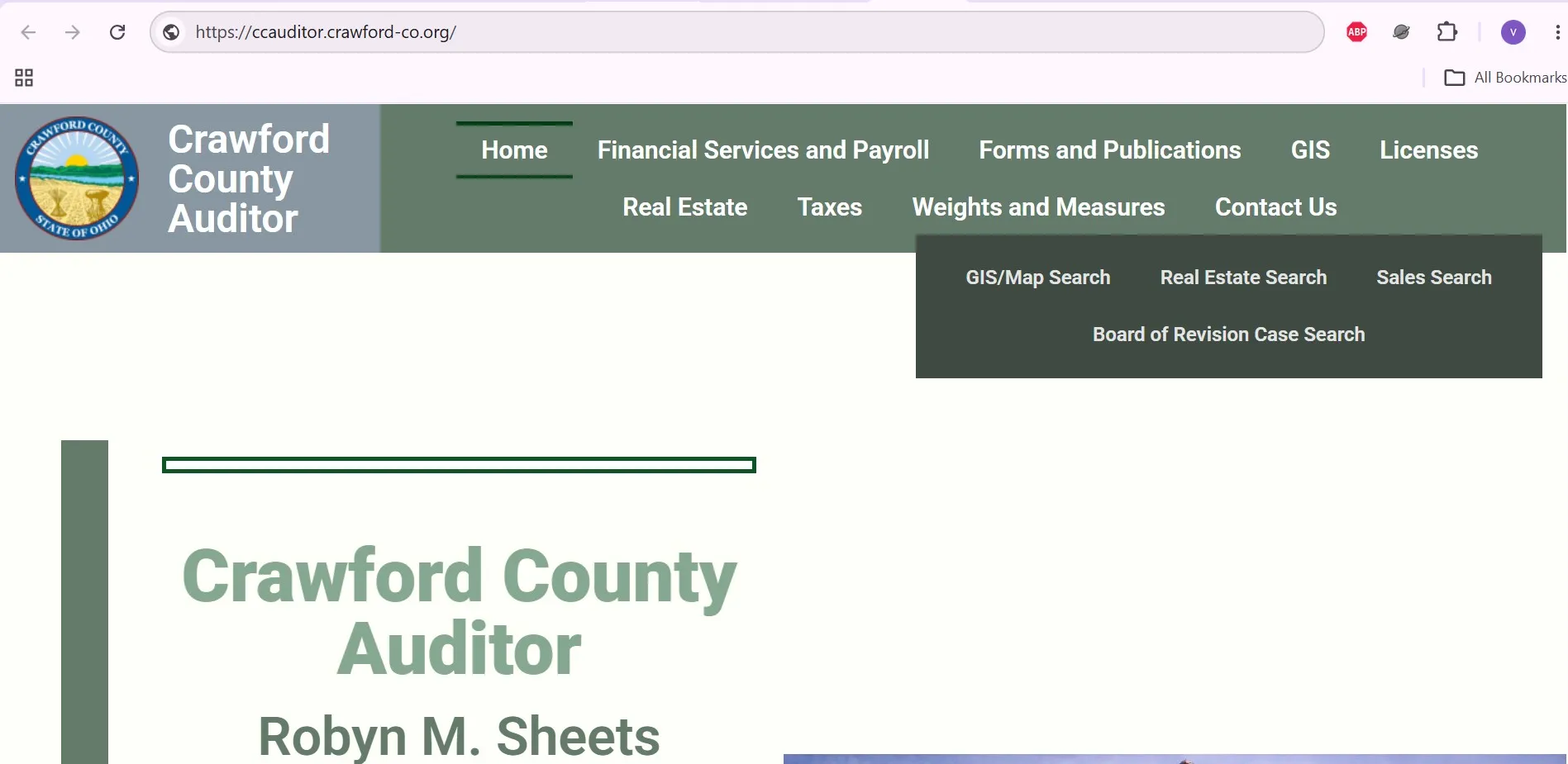
Open Crawford County’s official Real Estate Search, select Owner Name, Address or Parcel Number, enter the simplest version of your information, open the matching record and save the parcel number before using GIS, sales, tax-estimator, payment or Recorder tools.
Ten Crawford County property facts
After preparing one clean search value, open the official portal. Choose a search type, enter the criteria, run the search and compare every plausible result before opening the property record.
Jump to the exact property task
Each section below solves a different problem, so you can move directly to the action you need.
Which Crawford County office handles your question?
What you need |
Use |
What it provides |
Important limit |
|---|---|---|---|
Owner, parcel, address or value |
Auditor Real Estate Search |
Parcel, appraisal, land, building, transfer and tax-district information. |
The owner display is not legal proof of title. |
Parcel location and map layers |
Auditor GIS/Map Search |
Boundaries, ownership, aerials, districts, soils, floodplain and contours. |
GIS lines are not a legal survey. |
Recent market activity |
Sale Records Search |
Transfer and sale filtering. |
Not every transfer is an arm’s-length sale. |
Property characteristics |
CAMA Attribute Search |
Searches based on appraisal characteristics. |
Records depend on the fields stored by the Auditor. |
Tax bill or payment |
Treasurer |
Current balance, payments, delinquency, receipts and payment plans. |
The Auditor does not collect the payment. |
Deed, mortgage, lien or release |
Recorder |
Recorded document indexes and images. |
Recorder staff cannot complete a title search. |
Challenge market value |
Board of Revision |
DTE 1 complaint and hearing process. |
The Board reviews value, not dissatisfaction with tax rates. |
Homestead, owner occupancy or CAUV |
Auditor |
Applications, eligibility guidance and annual renewals. |
Each programme has different rules. |
Search Crawford County property records step by step
Prepare one search detail
- Select Owner Name.
- Enter the surname first.
- Add the first name only when too many results appear.
- Remove commas, initials and suffixes when nothing appears.
- Try a trust, estate, LLC or former-owner name when relevant.
- Select Address.
- Enter the house number.
- Add the main street word.
- Leave out North, South, Road, Street and unit numbers initially.
- Use GIS when a rural address or route does not match.
- Select Parcel Number.
- Copy the identifier from a tax bill, deed or previous record.
- Enter the complete number first.
- Remove punctuation only if the exact entry fails.
- Confirm the location before using the record.
Open the correct property result
No Crawford County property result found?
Prepare this information before calling
Understand the Crawford County property record
Field |
What it means |
What to check next |
|---|---|---|
Parcel number |
The county identifier for the taxable property. |
Use it for GIS, taxes, deeds, forms and office calls. |
Owner name |
The ownership name currently displayed by the Auditor. |
Use the recorded deed when legal ownership proof is needed. |
Situs address |
The property’s physical location. |
Compare it with GIS, road access and municipality. |
Mailing address |
The address used for owner or tax correspondence. |
Do not confuse it with the property location. |
Market value |
The Auditor’s opinion of fair market value. |
Review sales and physical facts before challenging it. |
Assessed value |
Generally 35% of market value in Ohio. |
Use the correct Crawford taxing district when estimating tax. |
Land value |
Value assigned to the land portion. |
Check acreage, use, soil data and CAUV status. |
Building value |
Value assigned to houses and improvements. |
Verify square footage, age, condition and outbuildings. |
Property class |
The recorded use or classification. |
Contact the Auditor if the actual use is materially different. |
Transfer record |
Sale or ownership-transfer information connected with the parcel. |
Use the Recorder for the actual recorded instrument. |
Taxing district |
The combination of levies and jurisdictions applying to the parcel. |
Crawford County has 54 districts; do not use another parcel’s rate. |
Why the property value and tax bill are different
Crawford County explains that real-estate tax begins with fair market value, applies Ohio’s 35% assessed-value ratio and then uses the rate for the property’s taxing district. Reduction factors, credits and special assessments can change the final bill.
Use Crawford County GIS maps correctly
Crawford County GIS provides parcel ownership and boundaries plus city, township, subdivision, tax-district and school-district overlays. It also includes aerial photography, roads, railways, address points, floodplain, soil maps, waterways and contour lines.
Find and inspect a parcel
Layer |
Useful for |
Do not assume |
|---|---|---|
Parcel boundaries |
Locating property and neighbouring parcels. |
That the line marks the exact surveyed boundary. |
Aerial photography |
Reviewing visible land and building context. |
That the image represents current-day conditions. |
Taxing districts |
Understanding which district applies. |
That a nearby parcel has the same tax rate. |
School districts |
Initial school-jurisdiction research. |
That mailing address determines the school district. |
100-year floodplain |
Early flood-context research. |
That GIS replaces an official flood determination. |
USDA soils |
Agricultural and CAUV context. |
That every soil or use question is resolved by one layer. |
Contour lines |
Understanding elevation changes. |
That contours replace engineering or site measurements. |
Use Sales Search and CAMA Attribute Search
Sales Records Search
CAMA Attribute Search
Use the CAMA search when you know the type of property you need but not a specific owner or address. It can help narrow records by appraisal characteristics stored in the county system.
After choosing your sale dates or property attributes, open the official real-estate portal and select Sale Records Search or CAMA Attribute Search from its menu.
Check tax dates, fees and payment status
Published deadline has passed.
Published deadline has passed.
Applies under the Treasurer’s published rule.
Confirm the current balance before paying.
Payment methods and fees
Method |
What you need |
Published fee or rule |
Practical step |
|---|---|---|---|
Online card |
Parcel and payment-card information. |
Approximately 2.5% processor fee. |
Review the displayed fee before confirming. |
Electronic check |
Routing and account numbers. |
$2.00 per e-check. |
Verify bank information and save confirmation. |
Telephone |
Current bill and parcel number. |
2.5% card fee; phone 855-825-0556. |
Keep the payment ID supplied at the end. |
Mail |
Check and all bill stubs. |
Mail to Suite 102 at 112 E. Mansfield St. |
Allow time for delivery and retain proof. |
Drop box |
Check and bill in a marked envelope. |
Located at the administration-building entrance. |
Do not place cash in the unattended box. |
In person |
Tax statement and accepted payment. |
Office hours 8:30 a.m.–4:30 p.m. |
Bring the current statement and parcel number. |
Micro steps for online or phone payment
Payment-plan options
The Treasurer publishes delinquent-tax payment plans intended to prevent additional penalties and interest when required payments are maintained. Prepayment plans also allow monthly payments toward the following year’s taxes through coupons or automatic bank withdrawal.
Find deeds, mortgages, liens and releases
The Auditor identifies the property. The Recorder maintains the official recorded document connected with a deed, mortgage, lien, lease, easement, release or affidavit.
Search Recorder records
Recorder fees and copy rules
Service |
Published charge |
Practical note |
|---|---|---|
Most recorded documents |
$39 for the first two pages, plus $8 for each additional page. |
Each printed side counts as a page. |
Marginal notation |
$4 for each reference. |
Added to the regular recording fee. |
Non-standard document |
Additional $20. |
Follow font, paper, ink and margin requirements. |
Document copy |
$2 per page. |
Provide volume and page information when requesting a copy. |
Plat or condominium drawing |
$0.10 per square inch, minimum $40 per page. |
Confirm the current size-based charge before filing. |
Bonnie Cotton
Suite 206
Bucyrus, OH 44820
Monday–Friday
8:30 a.m.–4:30 p.m.
Challenge an incorrect property value
Crawford County property owners may challenge the value used to calculate real-estate taxes between January 1 and March 31. The complaint should focus on market value or incorrect property facts rather than the amount of a voted tax levy.
Review the record first
File the complaint step by step
Issue |
Useful evidence |
Weak approach |
|---|---|---|
Recent purchase |
Contract, closing statement, deed and sale-condition details. |
Quoting only an online home estimate. |
Incorrect building facts |
Measurements, photographs, permits and floor plans. |
Saying only that the record is wrong. |
Property damage |
Dated photographs, reports and contractor estimates. |
Using ordinary maintenance as proof of major value loss. |
Comparable sales |
Similar, recent, arm’s-length transactions. |
Selecting only the lowest sale prices. |
Agricultural land |
Use, acreage, soil, production, improvements and CAUV facts. |
Comparing a working farm with ordinary vacant land. |
Check owner occupancy, Homestead, CAUV and damage relief
Programme |
Main purpose |
Key rule |
Form or action |
|---|---|---|---|
Owner Occupancy |
2.5% reduction for a qualifying principal residence. |
Own and occupy the home as of January 1; generally one home and one acre. |
DTE 105C. |
Homestead Exemption |
Reduces taxable value for qualifying homeowners. |
Age, disability, income, veteran or surviving-spouse rules may apply. |
DTE 105A, DTE 105I and supporting documents. |
CAUV |
Values qualifying agricultural land by crop-production value. |
Generally 10 acres or more, or $2,500 average gross income for a smaller tract. |
DTE 109 and annual DTE 109A. |
Damaged Property |
Requests value reduction after demolition, fire, tornado, flood or other qualifying damage. |
Relief percentage depends on when the damage occurred. |
DTE 26. |
Owner Occupancy
The Auditor says a homeowner may receive the 2.5% reduction when the property is owned and occupied as the principal residence as of January 1. A homeowner and spouse may receive the reduction on only one Ohio property, and the reduction generally applies to the home and one acre.
Homestead Exemption
CAUV agricultural valuation
- 10 or more acres used exclusively for commercial agriculture during the prior three years
- Or a smaller tract averaging at least $2,500 in agricultural gross income
- Multiple parcels may be combined when deeds are titled in precisely the same names
- $25 one-time enrolment fee
- Renew every year without an additional renewal fee
- Renew before the first Monday in March
- Report a change in agricultural use
Destroyed or damaged property
Damage occurred |
Application deadline |
Maximum published deduction |
|---|---|---|
January–March |
December 31 |
100% |
April–June |
December 31 |
75% |
July–September |
December 31 |
50% |
October–December |
January 31 |
25% |
Prepare a deed transfer, parcel split or recording
A real-estate transfer can require Engineer, Auditor and Recorder review. Do not send a deed directly for recording without confirming the legal description, conveyance forms and examination requirements.
Prepare the transfer package
Recorder formatting rules
Requirement |
Published rule |
|---|---|
Font |
At least 10-point computer font. |
Paper |
Minimum 8.5 × 11 inches; maximum 8.5 × 14 inches. |
Ink |
Black or blue ink; no highlighting. |
First-page margin |
Three inches at the top for Recorder, Auditor and Engineer use. |
Remaining top margins |
One and one-half inches. |
Side and bottom margins |
One inch. |
Contact the correct Crawford County property office
Office |
Use it for |
Contact |
Location and hours |
|---|---|---|---|
Auditor |
Property search, values, forms, Homestead, CAUV and appeals. |
112 E. Mansfield St., Suite 105, Bucyrus, OH 44820 Monday–Friday, 8:00 a.m.–4:30 p.m. |
|
Real Estate |
Parcel records, ownership display and appraisal questions. |
Auditor’s Suite 105 office. |
|
GIS/Mapping |
Map viewer, layers and parcel-map questions. |
Auditor’s Suite 105 office. |
|
Treasurer |
Tax bills, payments, penalties, receipts and payment plans. |
112 E. Mansfield St., Suite 102, Bucyrus, OH 44820 Monday–Friday, 8:30 a.m.–4:30 p.m. |
|
Recorder |
Deeds, mortgages, liens, releases and copies. |
112 E. Mansfield St., Suite 206, Bucyrus, OH 44820 Monday–Friday, 8:30 a.m.–4:30 p.m. |
Bring or include this information
Could the property be in a neighbouring county?
A mailing address or road near a county boundary can cause repeated failed searches. Check a neighbouring Auditor when the mapped location is outside Crawford County.
Useful for properties near the eastern Crawford County boundary or Mansfield-area records.
Open Richland County property-search guideUseful for properties near the northern boundary or a Seneca County jurisdiction.
Open Seneca County property-search guideWhat the online property tools cannot prove
- Finding and identifying a parcel
- Reviewing owner and address information
- Checking value, buildings and sales
- Viewing map and taxing-district context
- Locating the correct official office
- Legal title and ownership rights
- Exact boundary locations
- Zoning or building approval
- Unreleased liens or easements
- Purchase, lending and legal decisions
Crawford County property search FAQs
How do I search Crawford County property records?
Use the official Crawford County Real Estate Search. Choose Owner Name, Address or Parcel Number, enter the simplest version of the information, run the search and verify the parcel number and property location before opening the record.
Can I search Crawford County property by owner name?
Yes. Begin with the owner’s last name or the distinctive part of a trust, estate or business name. Add a first name only when too many results appear.
What should I enter for an address search?
Start with the house number and main street name. Remove directional letters, punctuation, unit numbers and suffixes such as Road, Street or Avenue if the complete address returns no result.
Why is the new owner not shown after a recent sale?
The Auditor and Recorder systems may not update at exactly the same time. Search the previous owner, review the transfer date and use the Recorder’s official document search to verify the recorded deed.
What is the difference between market and assessed value?
Market value is the Auditor’s estimate of fair market value. Ohio assessed value is generally 35 percent of market value and is used with the parcel’s taxing-district rates, reduction factors, credits and special assessments.
Are Crawford County GIS parcel lines legal boundaries?
No. GIS boundaries are useful for locating and comparing parcels but do not replace a recorded deed, subdivision plat or professional boundary survey.
When were Crawford County real-estate taxes due in 2026?
The Crawford County Treasurer lists February 9, 2026 as the first-half real-estate tax deadline and June 26, 2026 as the second-half deadline.
How do I challenge a Crawford County property value?
Review the parcel facts, gather evidence and file the current DTE 1 complaint with the Crawford County Board of Revision between January 1 and March 31.
How do I find a Crawford County deed or mortgage?
Use the Crawford County Recorder’s official online search. Search by grantor or grantee name and document type. The Recorder explains that property addresses are not maintained as a separate document-index field.
Who handles property-tax payments in Crawford County?
The Crawford County Treasurer handles tax bills, payment posting, delinquency and payment plans at 419-562-7861. The Auditor handles values, parcel records, exemptions and Board of Revision questions at 419-562-7941.

Khushboo Bobade is the editor and digital publisher of CountyAuditors.org. She oversees the research and editorial process for the website, ensuring that information about county auditor offices, property records, and government resources is accurate, verified, and easy for visitors to understand.
10 Ohio Property Tax Calculators & Auditor Tools
Built specifically for Ohio's 35% assessment ratio, current DTE forms, and 2026 Homestead, Owner-Occupancy, CAUV, Conveyance Fee, and Board of Revision rules. Every number reflects verified Ohio Department of Taxation amounts.
Annual Tax Bill Estimator
OHIOApplies Ohio's 35% assessment ratio plus your county's effective millage tier — the actual math your auditor uses.
Homestead Reduction Calculator
DTE 105A2026 Ohio Homestead: $29,000 general or $58,000 enhanced (100% disabled vet, KIA spouse). OAGI under $41,000 required for non-veteran applicants.
Owner-Occupancy & Non-Business Credits
DTE 105CEvery Ohio owner-occupied home qualifies for the 2.5% Owner-Occupancy Credit plus the automatic 10% Non-Business Credit. Most owners don't realize these stack.
Conveyance Fee Calculator
ORC 322When you sell or transfer Ohio property, the auditor collects $1 state + up to $3 county per $1,000, plus $0.50 per parcel. Counties choose their rate.
CAUV Agricultural Savings
DTE 109Ohio's Current Agricultural Use Value cuts taxable value dramatically for farmland (10+ acres, or smaller with $2,500+ annual gross income).
Mill Rate Converter
Ohio tax rates appear three ways on auditor sites: mills, percent, or dollars per $1,000. Convert between them instantly.
Parcel Number Cleaner
Ohio's 88 counties each format parcels differently — Franklin uses 010-123456-00, Cuyahoga uses 001-23-456, Hamilton uses 100-0001-0001-00. Auto-detects.
35% Ratio Sanity Check
Ohio law sets taxable value at 35% of market value. If yours is significantly higher, you're a strong BOR appeal candidate.
BOR Appeal Savings
DTE 1A successful Board of Revision complaint typically cuts your value 10–20%. Filing is free and stays in effect until the next reappraisal.
BOR Deadline Countdown
MAR 31Ohio's statutory Board of Revision filing deadline is March 31 for the prior tax year. Miss it and you wait until next year — no extensions.
Verify with the official Ohio source
These calculators use the verified 2026 Ohio Department of Taxation amounts and statutory rules. For your exact bill, exemption status, and county-specific deadlines, always confirm with your county auditor and the Ohio Revised Code:
Estimates use Ohio's 35% statutory assessment ratio and effective tax rate tiers averaged across major Ohio counties. Your actual bill depends on local school levies, voted millage, inside vs. outside millage splits, House Bill 920 reduction factors (HB 920), and special assessments. The 2026 Homestead general amount ($29,000) and enhanced amount ($58,000) reflect HB 187 inflation indexing — your county auditor's office may show slightly different transitional figures. Nothing here is legal or tax advice. CountyAuditors.org is an independent informational directory, not affiliated with any county government.